What Data Do We Use?
USGS Updated data
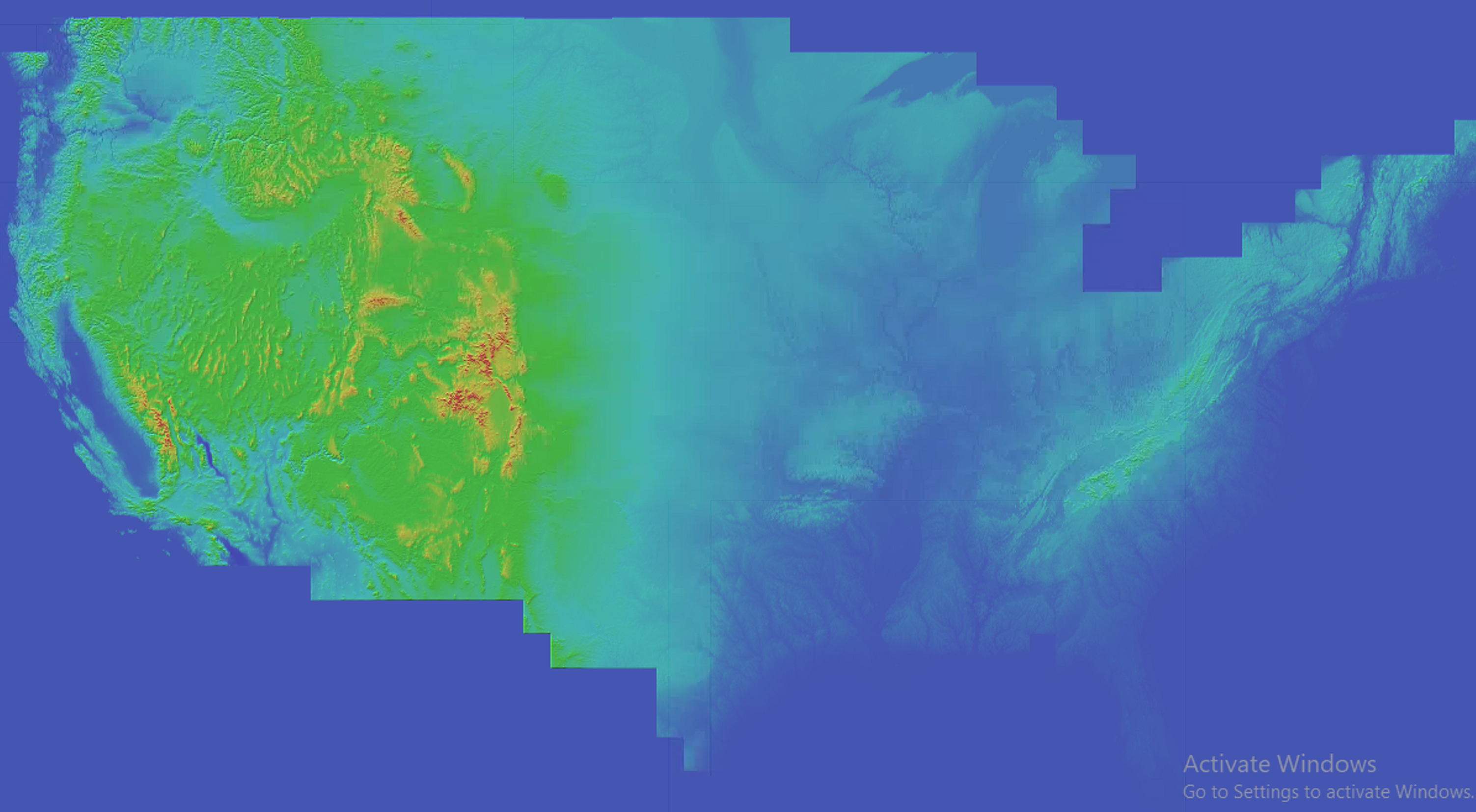
* Elevation data sources *
Resolution of Elevation Data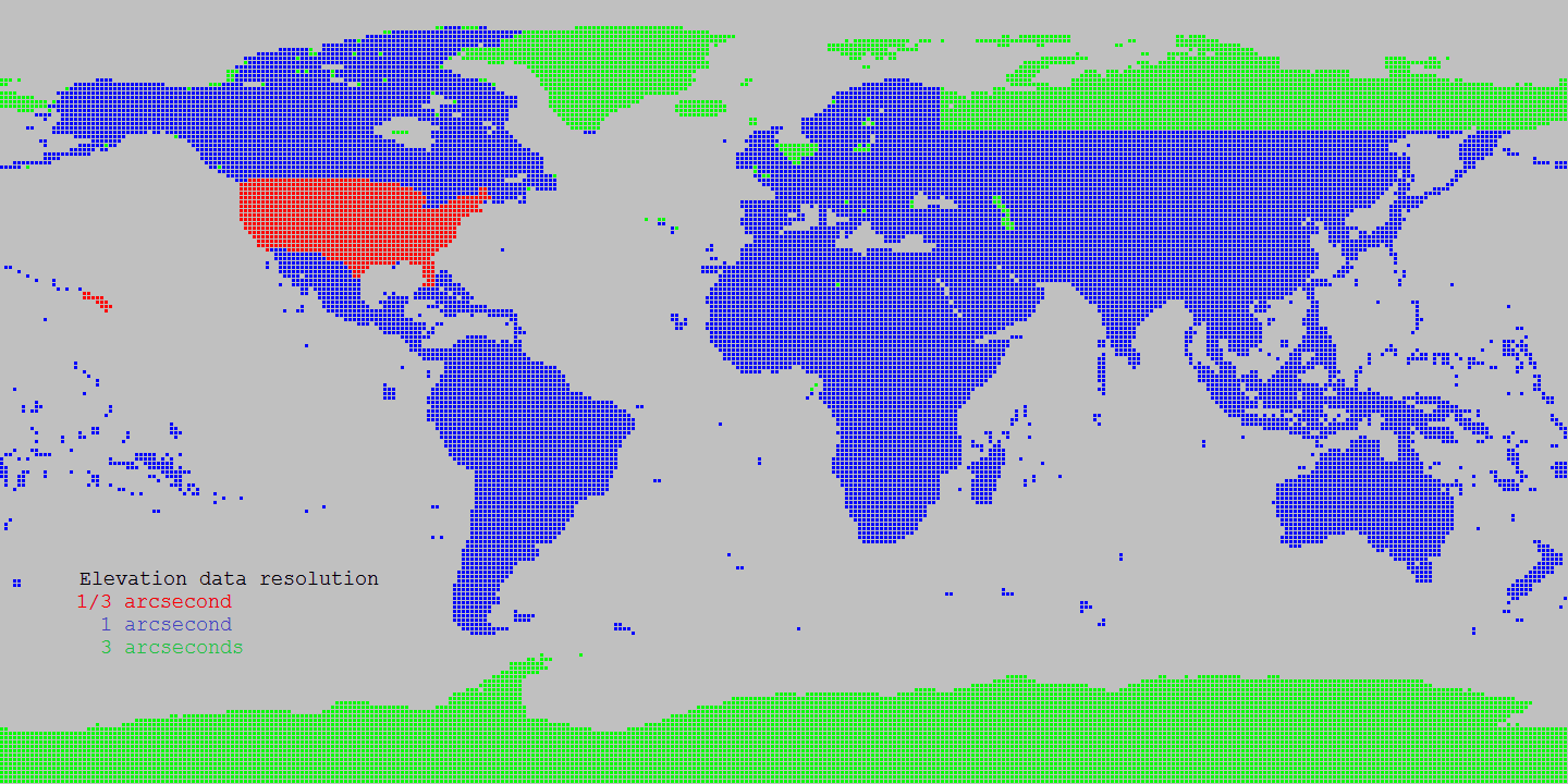
Source Shuttle Radar Topography Mission (SRTM) data products 1 arcsecond
Source for Alaska: USGS Alasaka NED 2 at Seamless data distribution system
Source for Northern Canada and void filling: Natural Resources Canada CDED at Geobase
Source for Northern Canada and void filling: Natural Resources Canada CANVEC at Geobase
Source for Northern Canada and void filling: ASTER
Source of SRTM Void filled for Eurasia: Viewfinder Panoramas
* Land cover data sources * Landcover Resolution
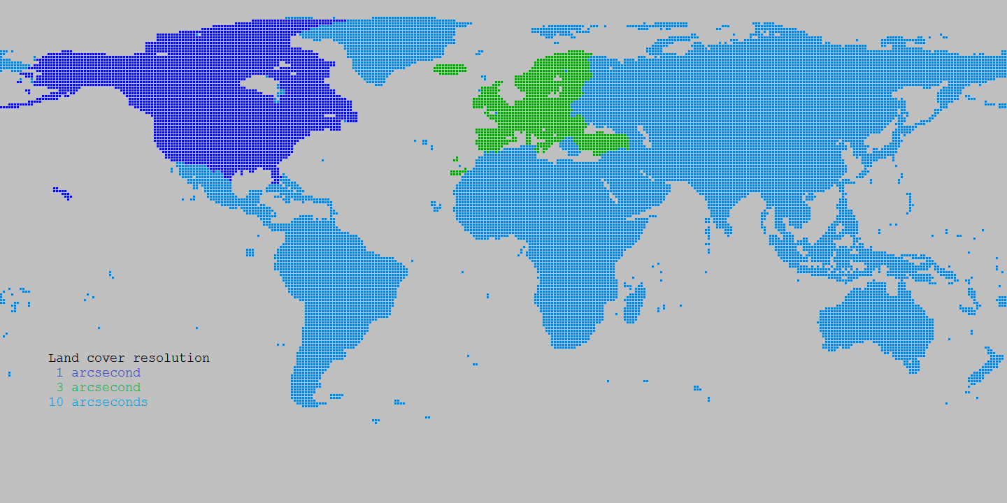
Source Canada: Natural Resources Canada Circa 2000 at Geobase
Source Europe: Corine landcover at European Environment Agency
Source World: Globcover at European Environment Agency