What Data Do We Use?
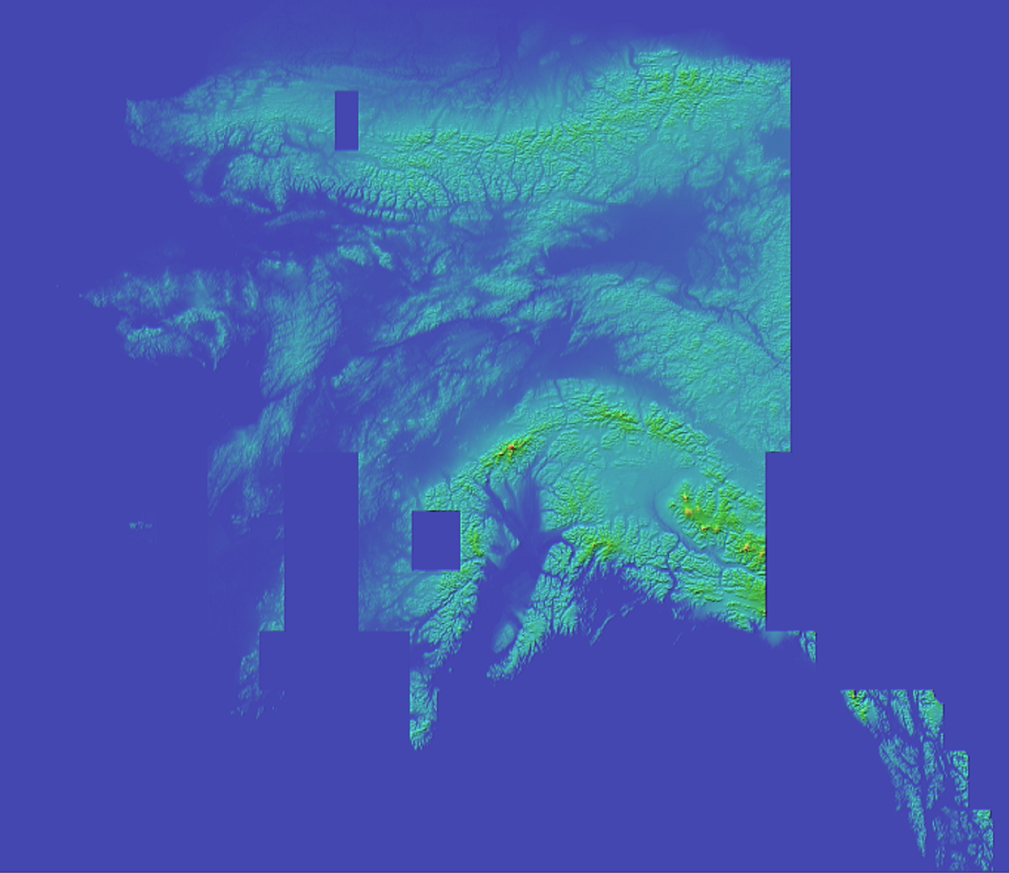
Lidar Data hasis beencurrently being added for the Area of New Zealand 4/18/2023
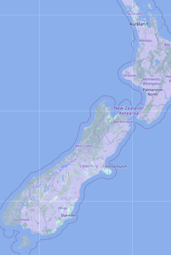
Lidar Image for New Zealand - Current Progress
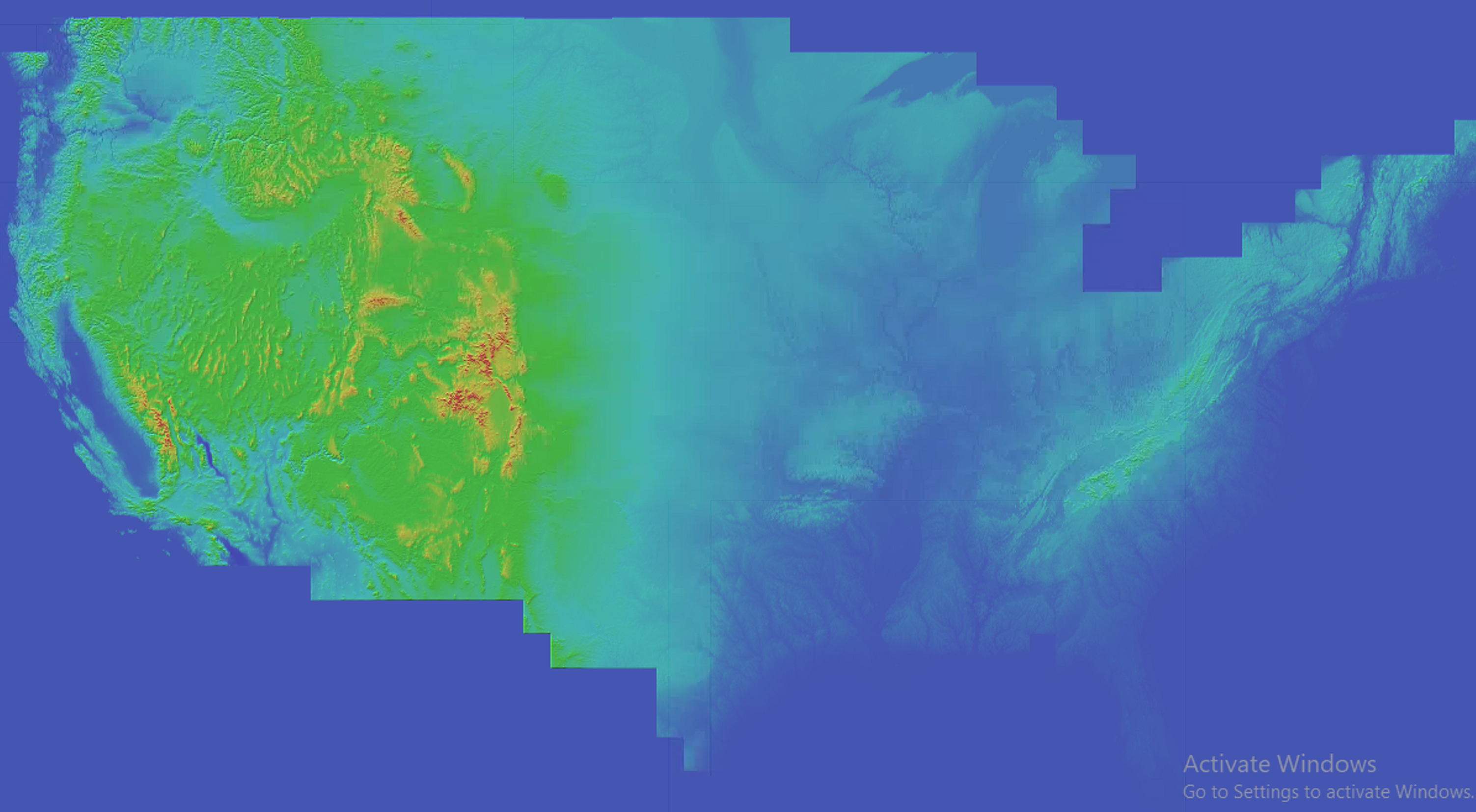
The USGS Data set has been updated as of 2/15/2023
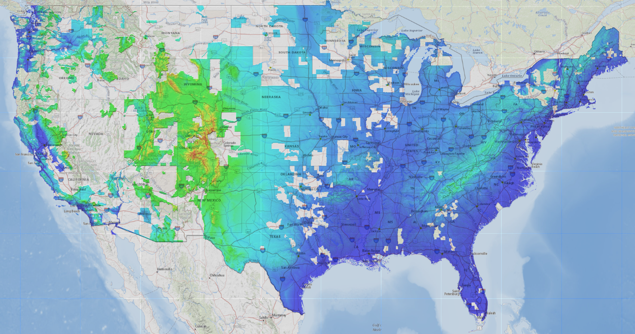
1 Meter
The USGS Data set has been updated as of 1/5/2023
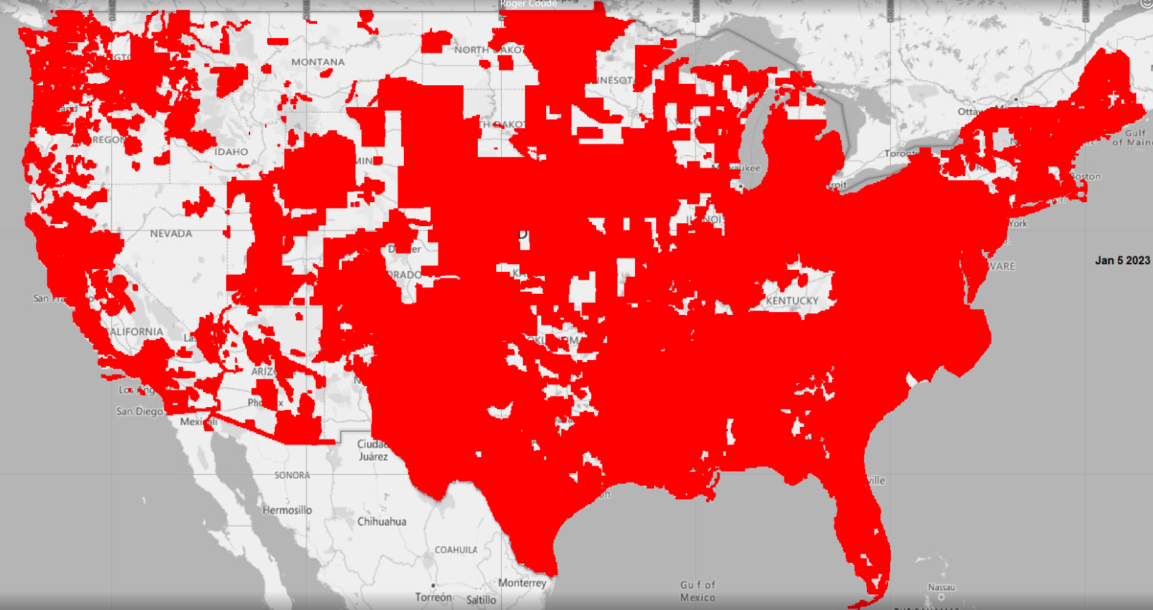
1 Meter
The USGS Data set has been updated as of 12/12/2022
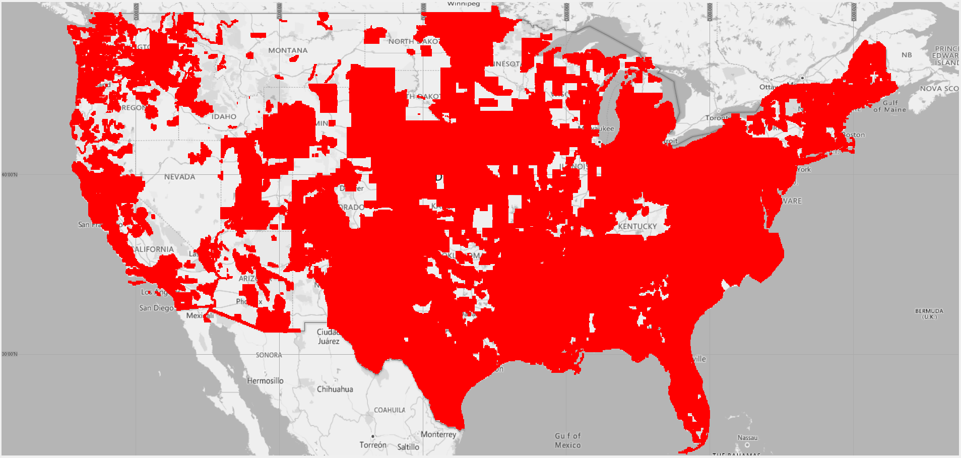
Updated USGS
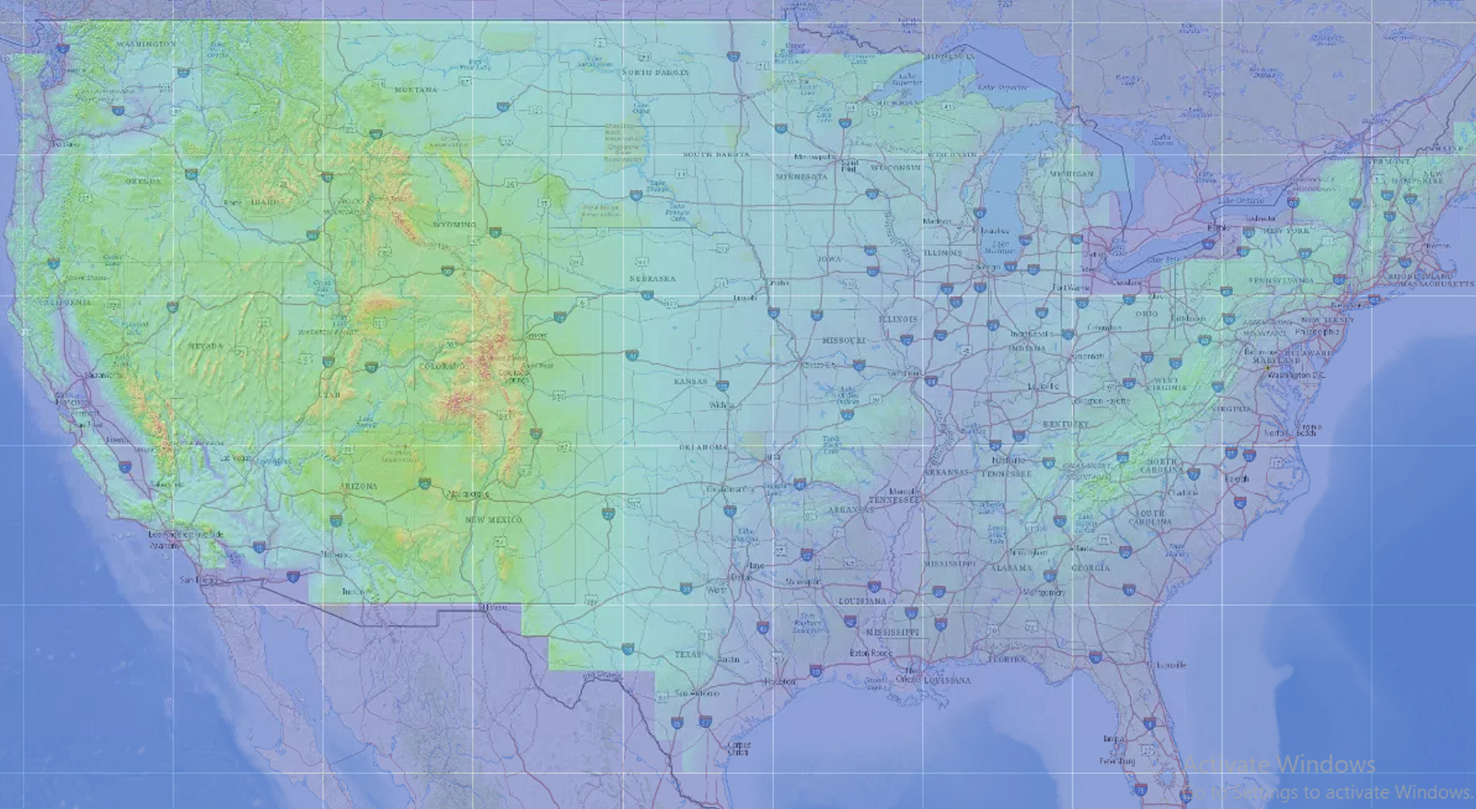
As of 8/2/2022, 1/9 ARC Data is available for the United States
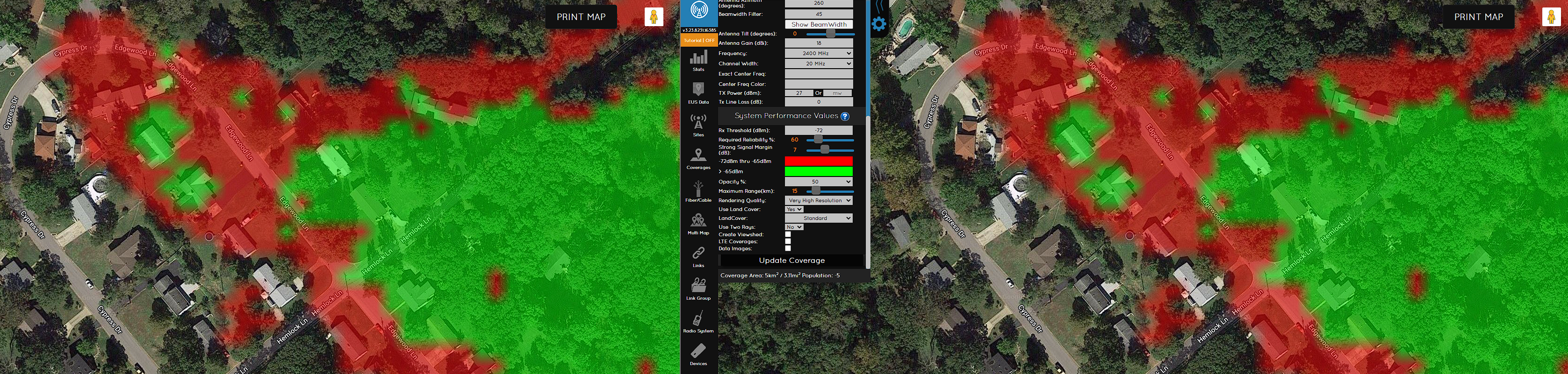
Ultra Vs Very High
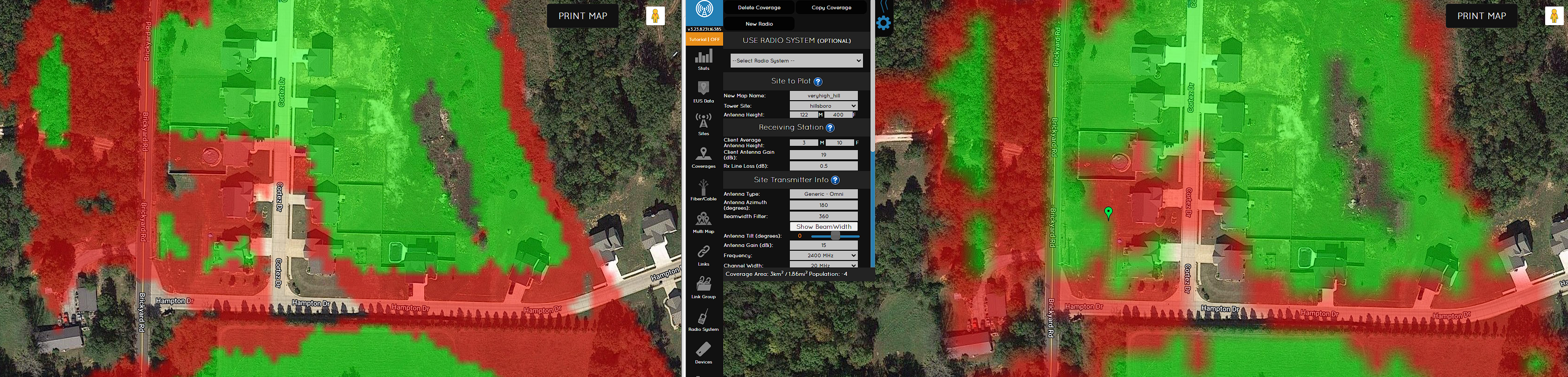
Ultra High Vs High
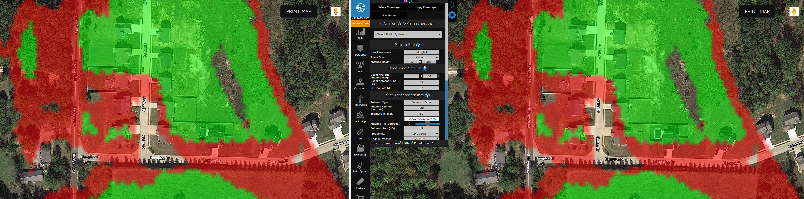
Ultra High Vs Medium
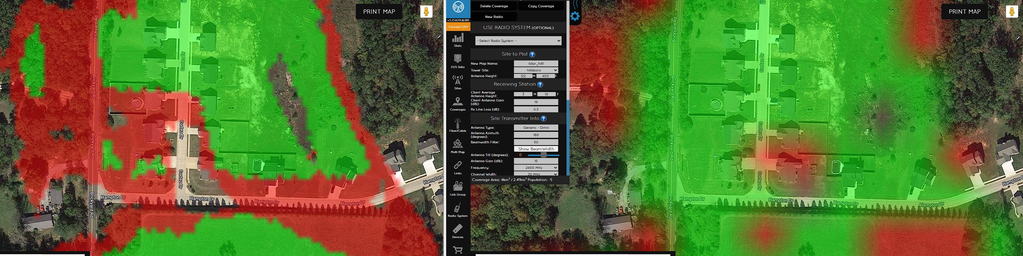
Ultra Vs Low
As of 2/24/2020, USGS Landcover for the lower 48 has been updated to 2016 data
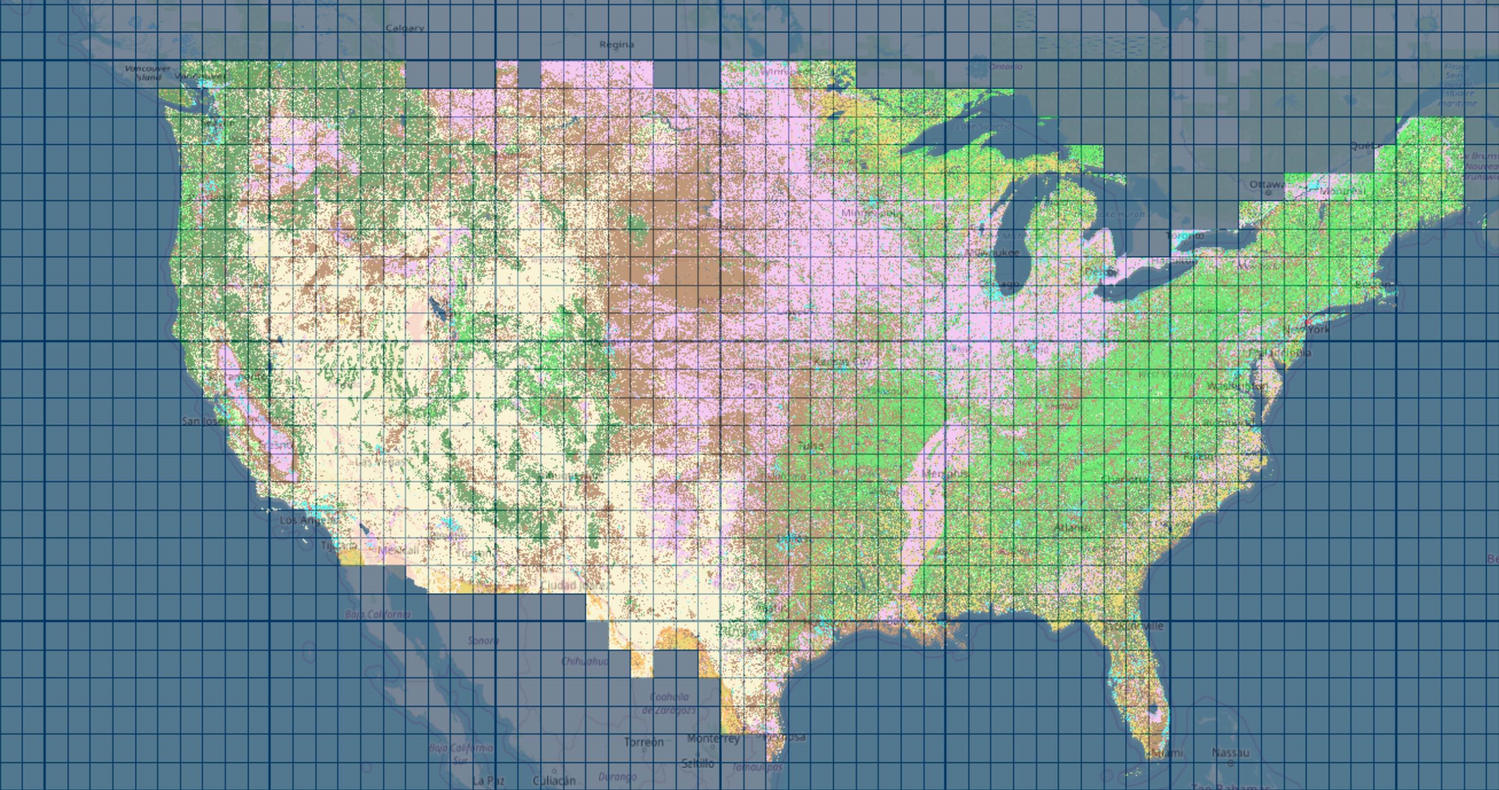
USGS Updated data
Elevation data sources
Resolution of Elevation Data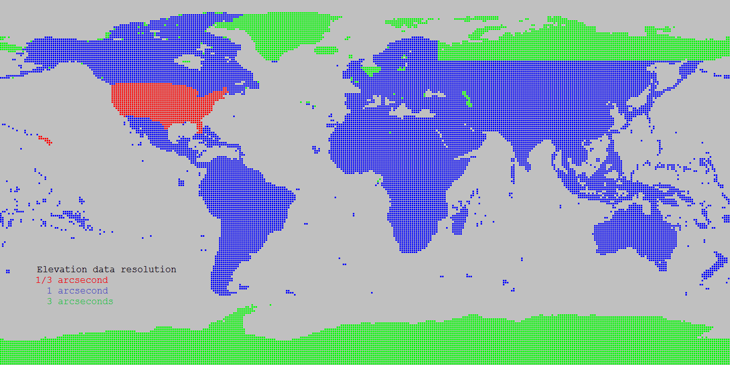
Source Shuttle Radar Topography Mission (SRTM) data products 1 arcsecond
Source for Alaska: USGS Alasaka NED 2 at Seamless data distribution system
Source for Northern Canada and void filling: Natural Resources Canada CDED at Geobase
Source for Northern Canada and void filling: Natural Resources Canada CANVEC at Geobase
Source for Northern Canada and void filling: ASTER
Source of SRTM Void filled for Eurasia: Viewfinder Panoramas
Land cover data sources
Landcover Resolution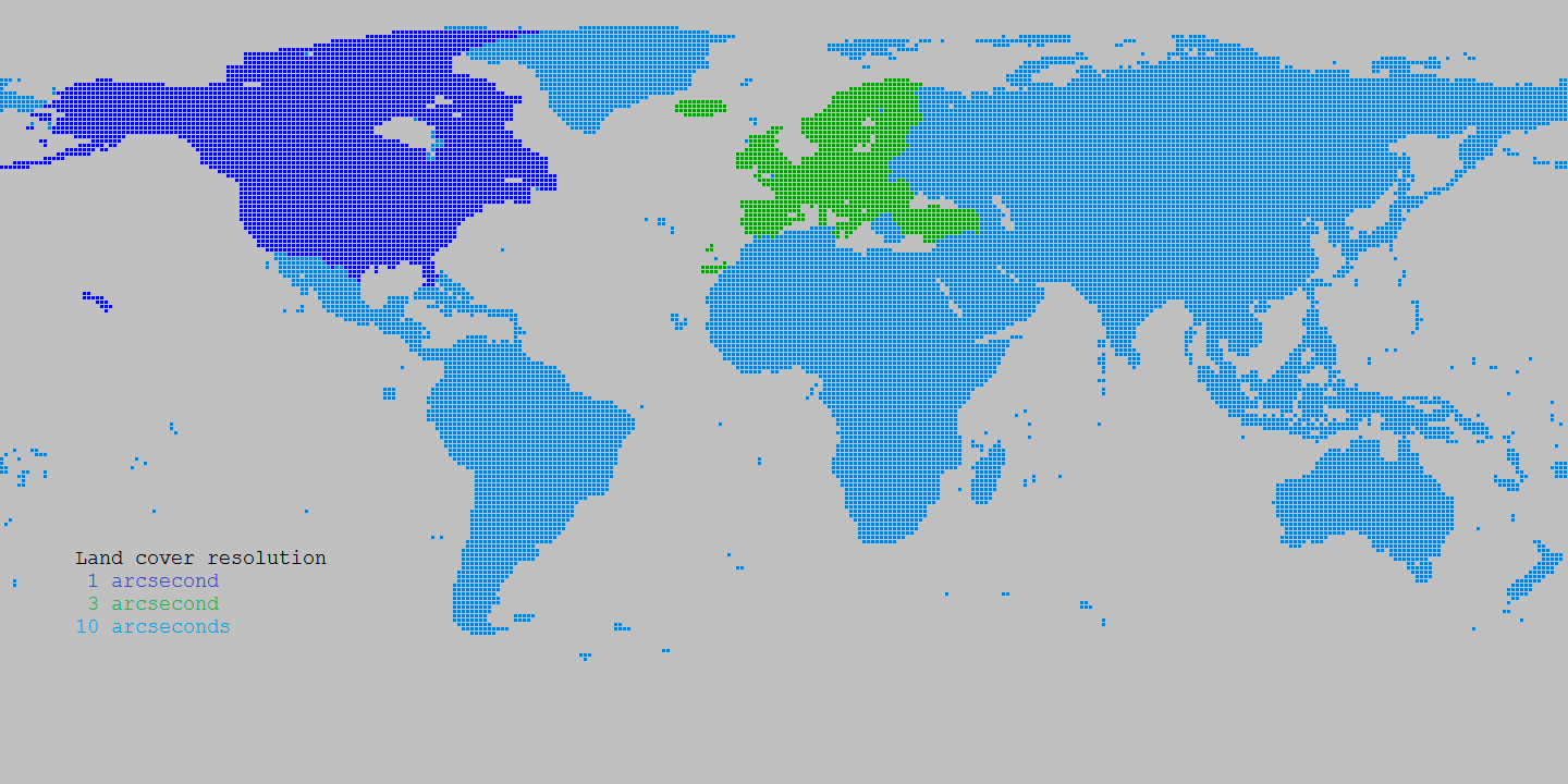
Source Canada: Natural Resources Canada Circa 2000 at Geobase
Source Europe: Corine landcover at European Environment Agency
Source World: Globcover at European Environment Agency